
Explore This Section Earth Home Earth Observer Home Editor’s Corner Feature Articles Meeting Summaries News Science in the News Calendars In Memoriam More Archives  2 min read
The FireSense Project Expanded coverage of topics from “The Editor’s Corner” in The Earth Observer
Wind is a major factor in fire. It controls how fires evolve and pose threats to the safety of communities. While weather balloons have traditionally produced vertical soundings to define changes in atmospheric dynamics, their use is restricted during aircraft operations to combat active wildfires. New technologies are needed to fill this critical measurement gap. The Uninhabited Aerial System (UAS) fits the bill, providing localized forecasting to help predict fire behavior.
The NASA Earth Science Division FireSense project, together with agency, academic, and private partners, completed an airborne campaign in a wildfire smoke-impacted airshed in Missoula, MT on August 27–29, 2024. During the three-day campaign, a NASA UAS team conducted eight data-collection flights– see Figure. They partnered these launches with weather balloon launches.
Using this real-time data, MITRE Corporation tested high-resolution “Score-based Data Assimilation” meteorological models and the National Oceanic and Atmospheric Administration (NOAA) High-Resolution Rapid Refresh (HRRR) operational atmospheric model against wind speed and temperature from local MesoNet weather stations. Environmental Systems Research Institute (ESRI) created comprehensive visualizations of flight paths, temperature, and wind.
The Montana campaign evaluated the impact of real-time data on model fire weather forecasts commonly used for operational decision making. The UAS sounding data was validated against weather ballon data. In addition, the campaign evaluated data validity from in-situ UAS soundings in a smoke impacted environment as well as assessed payload portability and user experience with the systems. The campaign served as a trial for interagency coordination between NOAA incident meteorologists and U.S. Forest Service (USFS) trained UAS pilots conducting data collection flights.
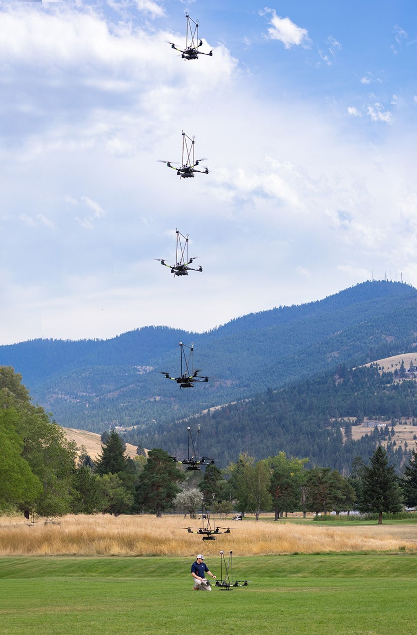 Figure. A composite image showing the NASA Alta X quadcopter taking off during one of eight flights conducted during the 2024 FireSense Uninhabited Aerial System technology demonstration in Missoula, MT. Image Credit: Milan Loiacono/NASA Steve Platnick
EOS Senior Project Scientist
Christine Mataya
FireSense Program Coordinator
Jacquelyn K. Shuman
FireSense Project Scientist
Michael Falkowski
FireSense Program Lead
Details Last Updated Mar 20, 2025 Related Terms Earth Science
